
United States | Democratic Participation
Article By Sofia Reed-Gomes & Isabelle Leber
July 28, 2026 9:23 am EDT
The Fight Over Congressional Maps: Understanding Redistricting in America
As states redraw congressional district boundaries ahead of the 2026 midterm elections, the battle over representation, voting rights, and political power is once again reshaping American democracy.
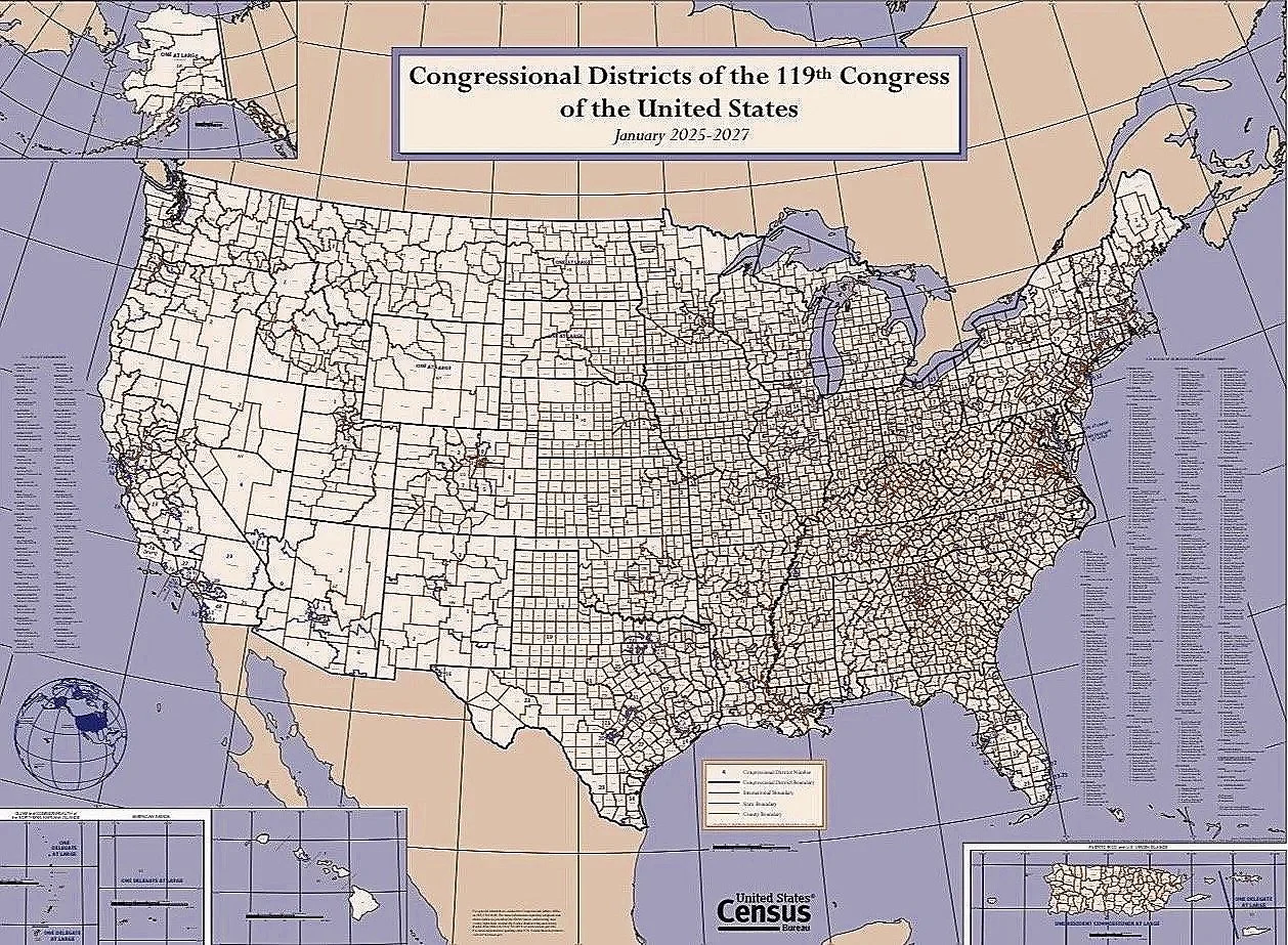
Congressional Districts of the 119th Congress of the United States. Photo: U.S. Census Bureau
Since 1970, only two states had voluntarily redrawn their congressional maps mid-decade for partisan advantage: Texas in 2003 and Georgia in 2005. Texas did so again in 2025, setting off a wider wave of redistricting ahead of the 2026 midterm elections.
The current redistricting efforts stem, in part, from the Supreme Court’s June 25, 2013, decision in Shelby County v. Holder, which held that Section 4(b) of the Voting Rights Act was unconstitutional. Section 4(b) identified which states and localities were required under Section 5 to obtain federal approval, known as preclearance, before changing their voting laws or district maps. By striking down that formula, the Court effectively ended the requirement.
In the years that followed, additional Supreme Court decisions narrowed other protections under the Voting Rights Act, including Section 2, which allows voters to challenge election practices that dilute minority voting power. The most recent of those cases, Louisiana v. Callais, further limited how race may be considered when states draw congressional districts.
On July 15, 2025, President Trump urged Texas Republicans to redraw the state’s congressional map to create more favorable seats for Republicans, telling reporters, “Texas will be the biggest one….Just a simple redrawing we pick up five seats.”
Missouri and North Carolina later pursued their own partisan redistricting plans, while Ohio redrew its map under a state-mandated process. Democratic-led California responded to the Texas effort by adopting temporary congressional maps intended to offset the additional Republican seats. Florida and Tennessee subsequently pursued new maps in 2026.
These new maps could shift the balance of power in the House, although their ultimate impact will depend on ongoing litigation and the results of the 2026 elections.
What Is Redistricting and How Does It Work?
To understand why redistricting has become such a powerful political tool, it is first necessary to understand how the process works and why it was created.
Redistricting is the process of redrawing congressional district boundaries to reflect population changes; the practice became a regular feature of congressional representation after Congress passed the Apportionment Act of 1842, which required states with more than one representative to elect them from separate districts rather than through statewide elections. By the 1960s, however, many states had allowed districts to become severely unequal in population, prompting a series of Supreme Court decisions that established the principle of “one person, one vote.”
Equal population does not by itself ensure that district lines are drawn fairly because states can create districts with roughly the same number of residents while still arranging the boundaries to weaken the voting power of Black voters, other minority groups, or members of the opposing party. When redistricting is used this way, it is known as gerrymandering.
Mapmakers generally use two techniques to weaken a group’s voting power or increase their party’s electoral advantage: packing and cracking. Packing concentrates a group of voters into a small number of districts, allowing them to win those districts by large margins while reducing their influence elsewhere. Cracking divides the same group among several districts so that it cannot form a majority in any of them.
One example of packing came after the 1990 census, when North Carolina packed heavily Democratic Black communities in Charlotte, Greensboro, and Durham into the 12th Congressional District, which stretched roughly 160 miles along Interstate 85. Although those voters could elect a preferred candidate in that district, concentrating so many Democratic voters in a single district left fewer Democratic voters in surrounding districts, making those districts more favorable to Republicans.
By contrast, Texas used cracking during its 2003 mid-decade redistricting by dividing the reliably Democratic city of Austin among several congressional districts and attached each section to larger Republican areas. Instead of forming a majority in one district, Democratic voters were outnumbered across several of them.
The Redistricting Fight Ahead of the 2026 Midterms
Texas lawmakers approved the congressional map requested by President Trump in August 2025 after two special legislative sessions, replacing the boundaries adopted following the 2020 census. Governor Greg Abbott described it as the “One Big Beautiful Map” and said it would ensure the state's congressional districts reflected Texans' voting preferences, but the League of United Latin American Citizens, individual voters, and other plaintiffs sued Governor Abbott and other Texas officials, arguing that lawmakers had divided and concentrated Black and Latino communities to weaken their electoral influence.
A divided three-judge panel of the U.S. District Court for the Western District of Texas concluded that the challengers were likely to succeed on their racial-gerrymandering claims and blocked the map from being used in the 2026 elections. Texas appealed in Abbott v. League of United Latin American Citizens, and on December 4, 2025, the Supreme Court stayed the district court’s ruling, allowing the map to remain in effect while the case proceeded. Following the decision, Gov. Abbott declared that Texas was “officially—and legally—more red,” referring to the additional Republican-leaning congressional districts created by the map.
California lawmakers could not counter Texas’s new congressional map by simply passing their own replacement because congressional districts in the state are normally drawn by the California Citizens Redistricting Commission rather than the legislature. Governor Gavin Newsom and Democratic lawmakers instead placed Proposition 50 before voters, asking them to temporarily replace the commission’s map with boundaries adopted by the legislature for elections from 2026 through 2030. The ballot measure described Proposition 50 as a response to Texas’s partisan redistricting, with Gov. Newsom arguing that California could not “sit idle” as Republican-led states attempted to gain additional seats. Voters approved the measure in November 2025, allowing the legislature-drawn map to be used through 2030, after which the commission will resume drawing the state’s congressional districts.
Missouri Governor Mike Kehoe called lawmakers into a special legislative session on August 29, 2025, to consider a new congressional map and changes to the state’s initiative-petition process. He also presented lawmakers with the “Missouri First Map,” which was drawn by his office. After signing legislation establishing the map on September 28, 2025, Kehoe said it would better represent Missouri’s conservative values and thanked President Trump, state lawmakers, and Missouri’s congressional delegation for helping advance it. U.S. Rep. Emanuel Cleaver, whose district includes much of Kansas City, argued that the map divided the city among three congressional districts and weakened the influence of its voters. He criticized the Legislature for putting “the wishes of Washington above the voices of their own constituents.”
North Carolina’s Republican-controlled legislature approved a new congressional map on October 22, 2025, in votes divided entirely along party lines: the Senate passed the map 26–20, and the House approved it 66–48, with Republicans supporting it and Democrats opposing it in both chambers. The new boundaries were designed to make the district represented by Democratic U.S. Rep. Don Davis more favorable to Republicans, potentially giving the party an additional seat in the U.S. House of Representatives. North Carolina had already replaced its post-census map in 2023, so the 2025 legislation redrew congressional districts that had been used for only one election.
Under Article XIX of the Ohio Constitution, the congressional map adopted after the 2020 census was valid only through the 2024 elections because it had not received the bipartisan support required to remain in effect through 2030. The Constitution therefore required the state to adopt a new congressional map in 2025. After the General Assembly failed to approve a plan with the bipartisan support required by the Constitution, the responsibility shifted to the Ohio Redistricting Commission, which unanimously approved a replacement map by a 7–0 vote on October 31, 2025. Unlike Texas, Missouri, and North Carolina, Ohio did not voluntarily replace a congressional map that had been expected to remain in effect through 2030.
With new congressional maps now in place across several key states, it remains to be seen how those changes will affect the 2026 midterm elections and whether they produce the additional Republican or Democratic seats their supporters intended. The full electoral impact of each map will not be known until voters cast their ballots in November.
How Redistricting Affects Minority Representation
Redistricting does more than determine which neighborhoods fall within a congressional district; It also influences whether communities have enough voting strength to elect candidates who represent their interests. As the United States has become more racially and ethnically diverse, that question has become increasingly important because much of the country's population growth has come from Black, Latino, Asian, and multiracial communities. How states draw congressional districts can therefore determine whether those communities gain greater representation in Congress or whether their growing populations are divided in ways that reduce their electoral influence.
For decades, one of the principal purposes of the Voting Rights Act of 1965 was to ensure that racial and ethnic minority communities had an equal opportunity to elect candidates of their choice. To help achieve that objective, many states created majority-minority districts, often in response to court rulings interpreting the Voting Rights Act. In these districts, a racial or ethnic minority made up a majority of the voting-age population. These districts were not intended to guarantee that a particular candidate or political party would win elections. Rather, they were designed to ensure that minority voters were not packed into a single district or split across multiple districts in ways that diluted their voting strength
After Shelby County v. Holder eliminated the federal preclearance system in 2013 and Louisiana v. Callais held that Section 2 of the Voting Rights Act requires proof of intentional racial discrimination, states gained greater latitude to redraw congressional districts without many of the federal safeguards that had existed for decades. Civil rights advocacy organizations such as the NAACP Legal Defense Fund and the American Civil Liberties Union argue that these rulings make it more difficult to challenge district maps that dilute minority voting strength. By contrast, conservative and libertarian think tanks such as the Heritage Foundation and the Cato Institute argue that the rulings restore greater authority over redistricting to the states.
What Redistricting Means for American Democracy
The current redistricting efforts by Democrats and Republicans have intensified concerns about partisan gerrymandering and may contribute to greater public skepticism toward the electoral process and the institutions responsible for administering elections. When politicians are able to redraw district lines in ways that help their own party, voters may begin to feel that elections are being decided before they even cast their ballots. Redistricting can also reduce some communities' influence over who represents them, particularly when voters are divided among multiple districts or concentrated within a single district.
As states continue to redraw congressional districts ahead of the 2026 midterm elections, debates over representation, voting rights, and the balance of power between the federal government and the states are likely to remain central to American politics. The maps adopted in the coming months will help shape not only control of the House of Representatives but also public confidence in the fairness of the electoral process.
This, however, does not mean that all hope is lost; instead, it should give Americans more reason to stay aware, remain informed, and take action in whatever way they believe is appropriate.
Co-author: Sofia Reed-Gomes is a student at the University of Chicago majoring in Public Policy, Economics, and Cognitive Science. Her interests include data-driven policymaking, economic development, and human-centered impact.
Co-author: Isabelle Leber is a student at the University of California, San Diego, majoring in political science with a specialization in international relations. She is currently an intern at the San Diego World Affairs Council, where she helps facilitate dialogue among people of different ages and backgrounds on pressing international issues.